
The Land Use Management, Evaluation and Optimisation tool
Unlock your land’s full potential
Designed for landowners and managers, the Land Use Management, Evaluation and Optimisation (LUMEO) tool will realise the full potential of your land. It combines satellite and farm-specific information to show you different land-use possibilities and what changes could
- generate more farm income
- increase carbon storage
- improve biodiversity.
Whatever you are hoping to do next with your land – diversify, sell biodiversity net gain credits, introduce solar, etc., – LUMEO will show you how to maximise the environmental potential of your land and make profitable choices.
LUMEO works at multiple scales, from individual field parcels to whole estates.
Enquire about LUMEOService lead

How can LUMEO help me decide what to do with my land?
LUMEO requires very little upfront information to get started. However, the more data entered, the greater help LUMEO will provide.
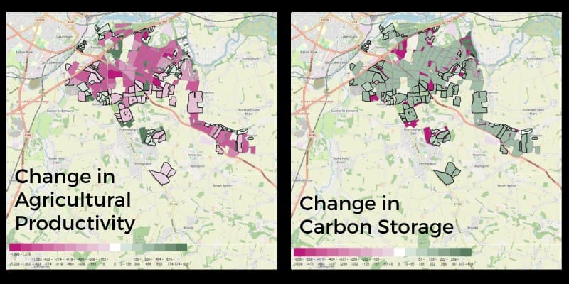
Using satellite mapping, the data entered and targeted machine learning, LUMEO performs several calculations to find all possible land use change options available. It then narrows these options down so you can view the ones that will result in your desired goal.

How do I pick the right land use option?
With this shortlist of options, LUMEO will map out where you could carry them out. It will prioritise land it deems as being underutilised, such as field corners or small, unproductive parcels. With each suggestion, LUMEO also performs a profit calculation. This enables you to compare multiple results and select the one that will give you the best financial return.

How else can LUMEO help me decide?
Financial return is not the only factor LUMEO uses to help inform your decision. It also puts its suggestions into context, showing you how your land use decision could benefit others and the wider environment.
For example, LUMEO will show how your land could help with
- supporting priority species and local nature recovery plans
- alleviating flood risk in your area
- providing education and recreation for your local community.
If you would like to try out LUMEO or learn more
LUMEO is intended to be used with the help of an advisor and is not open access. Please contact us and we will be in touch to get you started.
Contact us